Hurricane season expected to be mild in 2026, but officials urge Texans to stay prepared
May 21, 2026 | 2:25 pm ET

Description
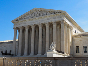
Texas Division of Emergency Management personnel monitor weather data prior to a press conference about Hurricane Beryl at the TDEM offices in Austin on July 5, 2024. (Eddie Gaspar/The Texas Tribune)
Forecasters at the National Oceanic and Atmospheric Administration are predicting a below-normal Atlantic hurricane season, officials said Thursday, citing the expected El Niño weather pattern which tends to suppress hurricane formation.
The agency forecasts eight to 14 named storms, with up to three potentially becoming Category 3 or higher hurricanes — which have wind speeds of at least 111 miles per hour.
Hurricane season starts June 1 and ends Nov. 30.
Last year was particularly quiet in the Gulf of Mexico — no named tropical storms or hurricanes made landfall in Texas. In 2024, Texas was struck by Tropical Storm Alberto and Hurricane Beryl — a Category 1 that left millions of Texans without electricity for days.
NOAA defines an average season as one with 14 named tropical storms and seven hurricanes, including three major hurricanes. The agency’s forecast predicts the formation of storms, not whether they will make landfall.
“Even though we’re expecting a below average season in the Atlantic, it’s very important to understand that it only takes one,” said NOAA Administrator Neil Jacobs. “We have had category fives make landfall in the past during below average seasons.”
The agency’s National Weather Service Director Ken Graham said one of the lessons from last year’s above-normal season was continuing their messaging on early preparedness.
“Don’t let words like below-average change the way you’re prepared,” Graham said.
The last time forecasters predicted a below-normal season was 2015, according to Matthew Rosencrans, NWS lead hurricane season forecaster. That year, no hurricanes made landfall and just two named tropical storms did, including Tropical Storm Bill that hit Texas in June.
NOAA has a 70% confidence level in these predictions and warns that the most active stretch will occur from mid‑August through late September.
El Niño is a naturally occurring climate pattern in the Pacific Ocean characterized by unusually warm surface water near the equator. In the Atlantic, El Niño is expected to strengthen upper‑level winds that can rip the tops off developing tropical systems and blunt their intensification.
While officials did not mention climate change, the agency said El Niño brings competing factors: warmer ocean temperatures that could support a more active year and wind conditions that can suppress storm formation. According to climate scientists, climate change is warming the Atlantic’s waters, which can super charge hurricanes that bring more heavy rainfall and higher storm surge when they make landfall.
Graham said early preparedness for storms is critical, especially because every Category 5 hurricane that’s made landfall in the U.S. has rapidly intensified from a tropical storm within a few days before making landfall.
He recommended that people have a clear evacuation plan, food, water and medical supplies that could last a couple weeks, a radio and a flashlight.
For more tips, here’s the Tribune’s guide on how to prepare for hurricanes.
Austin, TX