Iowa groundwater monitoring expands to all 3rd District counties with federal funds
Aug 07, 2026 | 6:28 pm ET
Description
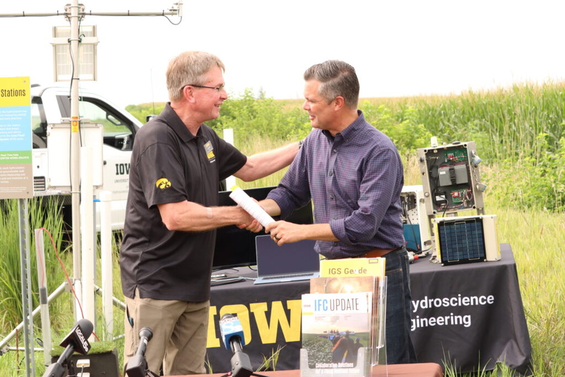
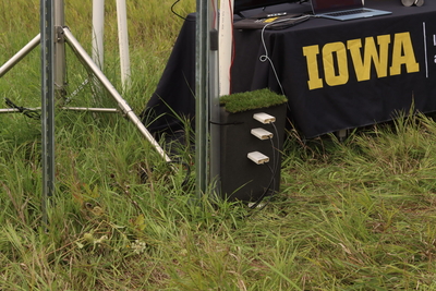
Larry Weber, left, spoke with U.S. Rep. Zach Nunn Aug. 7, 2026 in front of a new hydrologic monitoring station that will be installed and maintained with federal funding. (Photo by Cami Koons/Iowa Capital Dispatch)
ALLEMAN – Hydrologic monitoring stations that help researchers compile flood and drought information useful for farmers and communities will soon be deployed across all of southwestern Iowa, following funding announced Friday by U.S. Rep. Zach Nunn.
The $500,000 in federal funding will add 18 hydrologic monitoring stations to Iowa’s existing monitor network, and help establish the Iowa Drought Information System.
The monitoring stations will contribute to groundwater and rainfall networks that in turn inform farmers, communities and the public about floods, droughts and water quality.
Iowa already has 55 such monitoring stations across the state, but the latest batch of funding, appropriated at the request of Nunn, will add stations in 3rd District counties that don’t already have a monitor.
Nunn and researchers associated with the project spoke Friday at Lee Tesdell’s farm near Alleman, where the first installment on the project is slated.
The monitoring stations involve drilling a shallow well where monitors will sit to measure soil moisture and temperature at depths of 2 inches, 4 inches, 8 inches and 20 inches. Above ground, the stations look like 10-foot-tall tripods with a small solar panel and box that allow the systems to operate off grid. Two arms shoot off the top of the station with a thin membrane mechanism on each side to gather precipitation data.
Larry Weber, director of the University of Iowa’s Hydroscience and Engineering, or IIHR, said the monitoring stations take measurements every 5 minutes, providing near-real time data for Iowans. Weber said counties in the 1st and 2nd districts, and across other parts of the state, are already equipped with the stations.
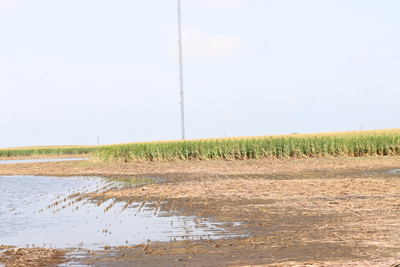
According to Weber, the information from a station in northwest Iowa helped a family decide when to evacuate their home in 2024, which ended up flooded by a storm event that U.S. Geological Survey estimates caused $310 million in damage.
Weber said data from the hydrologic monitoring helps communities plan responses to flood and drought events, and the hard data showing these conditions makes communities eligible for various funding programs.
Nunn said more flooding information would have been helpful for farmers and communities in central Iowa who were hit with more than two months worth of rain over the period of several days. Gov. Kim Reynolds and members of Iowa’s congressional delegation, including Nunn, are now imploring President Donald Trump for a major disaster declaration to help respond to the early July event.
“If there’s an opportunity to be proactive on this, to be able to find ways to help both droughts and floods, while at the same time monitoring things that are important to all of us — water quality, nitrates, phosphates, helping to have real information, hard science to help drive solutions to actually get after the source of the problem – that’s something we can all agree on,” Nunn said.
Water quality
Tesdell said in addition to the drought and flood information, the monitor will help his continued understanding of water quality. Tesdell, who has installed prairie strips on his century farm, has a diversified crop rotation including the perennial grain Kernza and uses cover crops and other conservation methods, regularly monitors nitrate concentrations in a creek that runs through his property.
He said the rainfall and soil moisture data help contextualize the big dip in nitrate concentrations he notices when the streams are swollen after a big rain, and the spike in concentrations as drainage tile empties into the waterways.
Weber said the hydrologic monitoring data will also feed into IIHR’s new project with NASA to develop a nitrate forecasting model that will help water utilities better respond to nitrate spikes in Iowa’s rivers.
Scott Cagle, with the U.S. Department of Agriculture’s Natural Resources Conservation Service, said the data from the stations will help farmers as they make planting and conservation practice decisions.
“One of the major things they can’t control is the weather, but they can mitigate it by studying it and learning from problems that they encounter with weather,” Cagle said.
Nunn said deployment of the new sensors are part of his work toward a “larger regional solution on how we analyze the data and how we protect farms.”
Nunn noted the House-passed Promoting Efficient Review for Modern Infrastructure Today, or PERMIT Act, which would change the definition of “navigable waters” and exclude certain water features from Clean Water Act protections, as part of this work.
Environmental groups opposed the Republican PERMIT Act and said it stripped Clean Water Act protections, while proponents said it cut red tape and kept the Clean Water Act from being weaponized.
Nunn led an amendment to the bill to create a voluntary pilot program to support state-led water quality improvement projects for nutrient impaired waterways.
He said the monitoring information also complements programs in the House farm bill, like a program to support precision agriculture applications.
“Whether it’s a drone application at a targeted time, but also at the best possible targeted time, whether it’s a mitigation for runoff at a time that precedes a major rain downpour, these are things that we can be smart about ahead of time with this real information coming at us, so we have the best possible tools for a farmer to be able to use proactively,” Nunn said.
The House passed its version of a farm bill in the spring, but a Senate version of the bill stalled in committee Thursday as lawmakers clashed over a nutrition program issue.
“I’m happy to see that it’s getting traction finally in the Senate … but I’m also frustrated that it’s now become a partisan exercise – this has never been the case before,” Nunn said of the action in the Senate. “… I want to see this be not only a bipartisan solution, I want it done this year.”
Accessing the data
The information gathered by the new stations and those already deployed can be found on the Iowa Flood Information System, the Iowa Water Quality Information System and eventually, the Iowa Drought Information System. The data from these monitors also inform the U.S. Drought Monitor, U.S. Geological Survey and USDA.
Weber said the Iowa Drought Information System will use artificial intelligence and machine learning to calculate soil moisture averages across the state, then relate that information to streamflow data and create drought forecasts.
“There’s real-time actionable data, and then there’s more scientific data for us to use in a bigger network of information,” Weber said.
Once the contract for the funding is finalized, Weber said the team will purchase the equipment, assemble the stations and begin deployment in spring 2027, “so that they’re out there ready to go for flood season.”
Des Moines, IA