$4.2 million in federal dollars to expand weather forecasting, flood warnings in Louisiana
Jul 13, 2026 | 5:47 pm ET

Description
A weather forecasting and monitoring network housed at the University of Louisiana at Monroe will double its number of forecasting stations across the region with $4.2 million dollars of federal money, the largest federal contract in the university’s history. (ULM Office of Marketing and Communications)
A weather forecasting and monitoring network housed at the University of Louisiana at Monroe will double its number of forecasting stations across the region with $4.2 million dollars of federal money, the largest federal contract in the university’s history.
The U.S. Army Corps of Engineers’ research division awarded the contract. It will expand the Louisiana State Mesonet, an interconnected network of 50 weather monitoring stations spread across the state.
The mesonet’s weather stations collect data on humidity, temperature, soil moisture, wind speed and other weather conditions. The additional 50 stations added will give forecasters, disaster planners and the U.S. Army Corps of Engineers more information on both daily weather and larger flood patterns in areas historically devoid of timely, reliable data.
“Improving our data collection in terms of weather data is one of those things that can have an immediate improvement on the lives of the public, because the weather service gets better information that allows them to issue more timely warnings,” said Todd Murphy, professor of atmospheric science at the University of Louisiana at Monroe and project lead for the Louisiana State Mesonet.
Despite having a wide variety of extreme weather conditions, Louisiana hasn’t always had a robust monitoring network, Murphy said.
“It’s not that we don’t collect weather data in Louisiana; we certainly do, but there are lots of observational gaps in the current network,” he said. “The whole goal of the Louisiana State Mesonet is to really fill in a lot of that coverage and provide observations where there was nothing.”
The new weather stations funded with the Army Corps’ dollars will also be more “nimble” and mobile than the other parts of the Mesonet, and placed in more remote areas than before, Murphy said
“We can put them in different places that really allow us to get closer to the river or to other waterways. We can be in areas where previously maybe you couldn’t get a concrete truck back there to pour concrete,” he said, expanding access to data that helps officials craft everything from flood maps to severe weather warnings for people living nearby.
“The kind of information you give the public: do you evacuate? Do you not evacuate? What do you do? Data is ultimately what drives those kinds of decisions.”
Along with better forecasting, researchers hope to use the data from the new monitoring stations to create more accurate flood models for the Corps, local officials and disaster planning institutions to use as they learn how to prevent damage from more frequent floods.
The funding contract also includes an option for an additional $4.2 million in funding for a second year of expansion should the Army Corps decide the project is accomplishing its goals.
“We’re very confident we’ll be able to do that,” said Murphy.
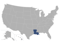
Baton Rouge, LA